Saturday, December 29, 2012

Lucky home owners

A skier on the river, striking out towards an island
There are many waterside properties along the Ottawa River. Friends of mine bought a house on the Ontario side this summer, at Wendover, east of Rockland; I went to visit them yesterday. Lucky people: it's a lovely house built in the 1990s and the views from their big living room windows would induce me to sit there all day, just gazing out, especially now that Francine has told me she can watch both sunrises and sunsets from that vantage point. On the horizon, across the river, is the escarpment of the Canadian shield, beyond Thurso, Plaisance and Papineau.

Fishing hut on the ice
At present, sheltered by a string of islands, the water is frozen along the stretch where my friends live (Cunningham Bay), and people were already venturing out on it on snowmobiles and skis. Nearby, one of the neighbours had set up a fishing hut on the ice. In a steeply sloping garden on the eastern side of the house, the children had made a toboggan / snowboarding run from the neighbour's house to the shore. They had a hut on that property, for warmth, with woodsmoke rising from its chimney.

In summer, floatplanes land and take off from here; Roger looks after one at a movable dock by his lawn, where he ties it down. He told us he was anxious about the dock during the autumn gales, before he'd dismantled it. If it hadn't been secured with metal ties, it would have disintegrated and the pieces would have floated away downstream.

Cunningham Bay from the air, a few weeks ago
The drive to Wendover and back along Highway 17A gave us many views of the river; on the exposed stretch near Rockland the surface snow had blown into ripples by the wind, like desert sand.

Wednesday, December 26, 2012

The Ottawa River on Christmas Day

To give ourselves an appetite for Christmas Dinner we went for a walk beforehand. Here are two views across the Ottawa River towards the Gatineau Hills in Quebec, from just above the Rideau Falls, mid afternoon.  The whiteness of the hills is an indication of the snow that remains stuck to the branches of every tree up there after last week's storm.

The air temperature was -9º (-15º taking the wind chill into account); we spotted a man skiing across the frozen surface of the river on the far side.

Wednesday, September 19, 2012

The history of Lowertown

One of our neighbours, Nancy, is the co-author of a very interesting 34-page publication that I discovered on the Internet today. It aims to document the history of our part of the city before too many of its older buildings are demolished and swept away by modern developers and is entitled Lowertown East, Our Disappearing Heritage.

On pages 6, 7 and 10 of this research paper are maps showing our neighbourhood in relation to the Rideau River.
To the north of the St. Patrick Street Parkway and east of King Edward Avenue, a small isolated section of Lowertown has evolved over the years and is fondly called the “Wedge” by some of its residents. Sometimes, it is also referred to as the Bordeleau Park community.
That's us.

Much of the paper describes the working class French, Irish and Jewish communities that once thrived here and incorporates old photographs from the early 20th century. It focusses on the history of three buildings that are about to disappear ...
The occupants, from over the years, of the four heritage buildings slated for demolition represent a true cross-section of the resourceful and resilient groups that made this river area of Lowertown East such a vibrant community. The "Brennan" house was built [~140 years ago] and occupied for many decades by working people of Irish descent. The "Gauvreau" rowhouse was built with money acquired by a descendant of one of the first Quebec inhabitants who used the land by the Rideau River first to build a hide and pelt business and then to build an income-generating rowhouse. The "Gauvreau-Bodovsky" house, built by the Gauvreau family, saw ownership transferred in 1921 to a Jewish family who for more than 50 years contributed to the commercial and cultural life of Lowertown. Finally, the “Ouellette” house was occupied by working-class French-Canadian families over the years and once included a convenience store.
What a contrast Claridge's new "Waterstreet" condominium complex will make to those old houses, when it is erected in their place.

The bridges are closed!

Minto Bridge West rehabilitation Union Street between King Edward Avenue and Stanley Avenue Monday, September 17 to Friday, December 14, 2012
 

This makes a difference to our usual evening walk; we'll have to be patient for the next three months and make a detour onto Sussex Drive to get across the Rideau from where we live. We no longer have such easy access to the New Edinburgh parks. The work on the Minto Bridges does need doing though. The boardwalk for pedestrians is rotting to the extent that one dark night we might have slipped through a hole into the river or at least broken an ankle. The bridge railings need replacing in several places too. I assume one or two snow removing vehicles must have slid into them on a slippery night and were only just saved from falling over the side.

Barriers have been across the road since Monday, but not across the footpath. I noticed a runner still using the bridge this evening.

It's getting colder and darker at the day's end, and the Rideau and Ottawa geese, who don't need bridges repaired, are gathering in larger and larger flocks in preparation for their migration. I saw them on top of a hill in the park, silhouetted against a clear autumn sky this evening.

*****

Also see my later post about the bridge rehabilitation, published 14th January, 2013.

Monday, August 20, 2012

The silvery falls

We hadn't been to the Rideau Falls for a while but walked there with friends after supper last Friday. The falls seen from the side had a beautiful silvery sheen to them in the evening light. A solitary duck standing on the lip looked as if it might get washed over at any moment, but the flow is relatively gentle at this time of year; I think it liked the view from there. A sunset cruise boat approached slowly to the nearest point it could reach at the bottom of the falls. Why do the boat companies feel obliged to broadcast loud music on their cruises, ruining the peace of the evening? I don't understand it, and nor do I understand why the NCC and other interested parties (that should read "uninterested," probably) have still done nothing about restoring the viewing platform at the falls and the derelict building there that used to house the Canada and the World Pavilion? A runner came by, found he couldn't get through the fences blocking off the terrace, and had to turn round and run back the way he'd come.

A new name for the Parkway

The Ottawa River Parkway is no more––since last week it has become the Sir John A. MacDonald Parkway, in honour of Canada's first prime minister. The Ottawa Citizen article about this includes 10 photos and a video clip of the renaming ceremony at which Sir John A's ghost turned up in a top hat, accompanied by his wife, Agnes.

Monday, August 13, 2012

A very pleasant walk

We covered about 16 kilometres on foot today, starting out this morning with the intention of walking about half the distance my husband rides on his bike to work, up the Ottawa River trail towards Kanata. His whole journey, one way, is about 25 km and he usually manages that distance in just over an hour, pedalling hard.

To reach his half-way-to-work point in a more leisurely manner (he's on holiday at present) took us about three hours, and then we deviated to Lincoln Fields for a pub lunch before catching the bus back to town (we also had to walk home through town). We enjoyed it so much that we'll probably do it again before long, either in the other direction from Lincoln Fields back to our house, or from the Kanata end to Lincoln Fields which would take us through the Britannia Beach district.

Anyhow it made a super walk for a summer morning. The route we took today led us below Parliament Hill and up the hill by the Chaudière Falls to the War Museum, then along the river bank past Remic Rapids and a couple of beaches. Plenty of benches tempted us to take a rest on the way; after 6km or so we sat for 20 minutes on one near the stone sculptures talking to another couple who regularly cycle along this trail.

The river level is still very low, exposing large extents of bed rock and gravelly sand, but the shore is not quite as dry as it was before the recent heavy showers which have turned the grass by the parkway green again. Water lilies and globe flowers were in bloom in the shallows and families of geese (practising their circuits) and herons were much in evidence all the way along.

On some short sections there's a chance to walk beside the bank away from the cyclists and speed skaters along the remains of a former trail. Less well maintained than the main trail, these deviations are only suitable for walkers––plenty of benches on those stretches too, though, under shady trees.

Ferry me over!

I cannot get to my love if I would dee 
The waters of Tyne run between him and me 
And here I must stand with a tear in my ee 
Both sighing and sickly, my true love to see 

Oh where is the boatman, my bonny hinney? 
Oh where is the boatman? Bring him to me! 
To ferry me over the Tyne to my honey 
Or skull him across that rough river to me.  

Oh bring me a boatman, I'll give any money
And you for your trouble rewarded shall be
To carry me over the Tyne to my honey
And I will remember the boatman and thee.

The Ottawa River is not the Tyne, but there's probably just as much need for a ferryman here between Ottawa and Gatineau to carry the lovers or the tourists across to one side of the river or the other. Today we finally saw proof that such a service has begun to exist and I'm very glad to advertise it here on my blog. The skipper (who comes from Worthing, in England) told us that he and his associates at Au Feel de L'Eau had been lobbying the National Capital Commission for several years to allow their Aqua Taxi service and that this year permission was finally granted, especially because the boat being used is an electricity powered vessel which doesn't pollute the river. Every evening after a longer than normal journey via Lac Leamy its batteries are recharged at the Gatineau Casino and for $20 you can take that ride. Normally, however, the water taxi simply operates between the dock next to the Rideau Canal locks below Parliament Hill and the Museum of Civilisation on the opposite bank. That short ride that costs just $5 will save you a couple of kilometres' walk across the Alexandra Bridge. Up to 10 people can come on board at once.

Here is some more information about the service.

Tuesday, July 31, 2012

Martin's river walks

One of my Facebook Friends, who has been living near the Ottawa River for a long time, has recently been taking photos along its bank and uploading them onto his Facebook wall; he calls them his River Walk pictures.

He describes or comments on them. "Every time I stroll the shore, I pick up some glass or plastic bag," he says, but he leaves most of his finds untouched. He points his cellphone camera at driftwood, at falling water in a small tributary (he likes the way it sounds), at a stone in the grass, at the cracks in a "bedrock formation" on the shore. There are close-ups of the bark of a white oak and of long "water grass," pictures of geese and ducks, a pink beach ball, a metal hoop on a ring attached to a rock and rusted long ago (presumably meant for the painter of a boat) and more conventional ones of a typical sunset. Like me, he appreciates the stone sculptures created by John Félice Ceprano at the Remic Rapids.

The other day, exploring the shore, Martin found something really interesting: an old pipe bowl "Manufactured about 1700-1850 with a long stem. Marked T D or Thomas Dormer from Dorset, England. Broken off ... and tossed overboard ... Lying half above the sand in shallow water, this artifact has rested on my river walk stage and has beautifully illustrated an earlier time of canoe trappers and traders, log booms and chanty men."

The photo he posted this morning was of the corpse of a small cat in the shallows, beside a pile of litter. "Sad resting place for a black cat!" he added.

Tuesday, July 3, 2012

Petrie Island

Fireworks were set off from Petrie Island too, on Canada Day, as I know from someone who lives in Orleans.
Petrie Island beach on a quiet day

3000 years ago Algonquin and Iroquoian peoples probably used this as a fishing area and no doubt the early explorers and fur traders from Europe camped here in the old days. Captain Petrie, a mid 19th century leader of the Cumberland community, had the first road between Ottawa and Montreal constructed in 1850, and gave his name to the island. Before the Carillon dam between Hawkesbury and Montreal in 1962-64, many long, wide, sand beaches existed on the banks of the Ottawa. Petrie Island, still full of sand today, used to have four cottages. A fire in 1900 destroyed over 3000 buildings in Hull and Ottawa and some residents camped here while their homes were being rebuilt. In the 1950’s portion of the Island was used as a rubbish dump. The National Capital Commission purchased the Islands in 1983 for preservation of the wetlands and five years later the Province of Ontario designated it as a significant area of scientific interest: a Class 1 wetlands area. Over 130 different kinds of birds have been spotted here and it's the home of many rare plants as well.

At the eastern end is Stuemer Beach and Stuemer Park, a reference to the Stuemer family who sailed around the world from here (in 1997) and back to here (in 2001) on their boat Northern Magic. When the voyage was over, the mother, Diane, who had been sending regular dispatches to the Ottawa Citizen, reporting on their progress, published these in a book, but sad to say she died shortly afterwards (in 2003).

I see that the Friends of Petrie Island website has been updated, with an impressive list of what recreations are available there, on the Activities page. Go to the Bait and Tackle shop at Ozile's Marinaand you can rent a pedal boat, a kayak or a boat for fishing expeditions.  From the lifeguards' office you could also rent a volleyball net.  Personally I'd avoid this area at weekends to stay clear of the crowds; most of the facilities are open on weekdays too during midsummer and on the beach lifeguards are on duty every day from noon till 7p.m.

Monday, July 2, 2012

Explosions of joy and all the boats

At nightfall on Canada Day, yesterday, Chris and I stood on the MacDonald Cartier Bridge over the Ottawa River waiting for the start of the fireworks to be launched from Nepean Point. We'd walked there from our house. Canadians, young and old, of multiracial origins but mostly dressed in red and white. We were families, groups of friends, couples or people on their own, all hanging over the railing for the whole length of the bridge as traffic rumbled by behind us. A few people had carried lawn chairs to sit on and some of the children sat in strollers to wait. Below us, the river was covered with little boats at anchor, over 100 of them for sure, too numerous to count. Small groups of people on board were partying and each boat had a stern light to show the others where it was. Police boats with blue lights were patrolling the line of boats closest to the Nepean Point headland, to make sure nobody sailed any closer to where the spent fireworks would fall. 

The show began promptly at 10 o'clock in ideal weather conditions, not too hot, with just enough of a breeze to keep us cool but not too much to affect the trajectory of the fireworks whose colours were reflected in the windows of the high buildings on the Gatineau side of the river. After 15 minutes the fireworks came to a noisy climax and a huge, high bursts of colour. (The highest shells can climb over 300 metres into the air, i.e. to over 1000 feet above ground level). When the last burst had faded away, the watchers on both banks and on the boats and bridges applauded and cheered. Then everyone walked home or back to where they'd parked their cars in a cheerful mood, under a bright full moon.

There was no shouting or pushing or complaining and no rowdiness at all. Very well behaved people, these Canadians!

Sunday, June 24, 2012

Raw sludge and what they do with it

It takes a long time to turn raw sewage into clean water that can be channelled into the river without polluting it; ROPEC, the Robert O. Pickard Environmental Centre is the waste water treatment plant in Ottawa that does exactly that. Chris and I had a guided tour of it on the Doors Open day at the beginning of this month. We found it fascinating.

"Thirty-five rain-barrels of sewage per second are collected here, representing 30 million toilet flushes per day," so we were told at the start of the tour by Michel Chevalier, the Managing Director for water treatment in Ottawa, as we stood in the main building where V16 generators can react to a power outage within seconds. In the underground corridors down which we were led were very long parallel pipes carrying this "raw sludge" along the first stage of its journey through the works or fibre optics cables for the PLCs (Programmable Logic Controllers) responsible for the machinery. Every part of the system is automated, to the extent that it only requires two human operators to be present in the control room at any one time.

There are 5000 km of sewer pipes buried in the national capital and they all lead to this site. 100 ft below the surface the sewage is filtered through a small screen 4 inches wide where the larger "debris"––i.e. bits of washing machines, golf balls, toys, people's dentures, vegetable knives, stones, toys, bank cards, you name it––are trapped and retrieved, to be put into a smelly dumpster (skip) that fills to capacity every month, its contents to be buried in a landfill. The rest of the sludge is pumped up to ground level, then "gravity fed" through the plant. The start of this occurs in an open channel where the smaller debris and grit is filtered out, bubbles keeping the particles in suspension.

Holding our noses or trying not to breathe too much, we were guided across a bridge over this channel and then through a pungent enclosed area where big vats stored the interesting mix, with "sampling nipples" on their sides.

Large "settling tanks" covered in concrete receive the sludge where oils can rise to the top as scum to be skimmed off––though people ought not to put fats into the sewage, they do––and the organic mush can sink to the bottom. Now these heavier parts can be dealt with. A process called "anaerobic digestion," lasting from 15 to 25 days, converts some of it into carbon dioxide and methane, the latter of which is retrieved and converted into electricity to power the machinery and heat the buildings. Excess methane is burned off there and then, and it has to stay alight in case of flares. We saw it burning quite impressively, like the Eternal Flame on Parliament Hill. The remaining "bio mass" is centrifuged to separate the liquid from the bio-solids. The solid stuff, being rich in nutrients, can eventually be carted away and used as fertilizer on our fields.
Clean water at the end of the process

By means of aereation (i.e. bubbles of air), oxygen burning micro-organisms can now break down the small particles in the water that remains from the original sewage; our guide spoke of a sour dough recipe as an analogy and called these tanks clarifiers. 

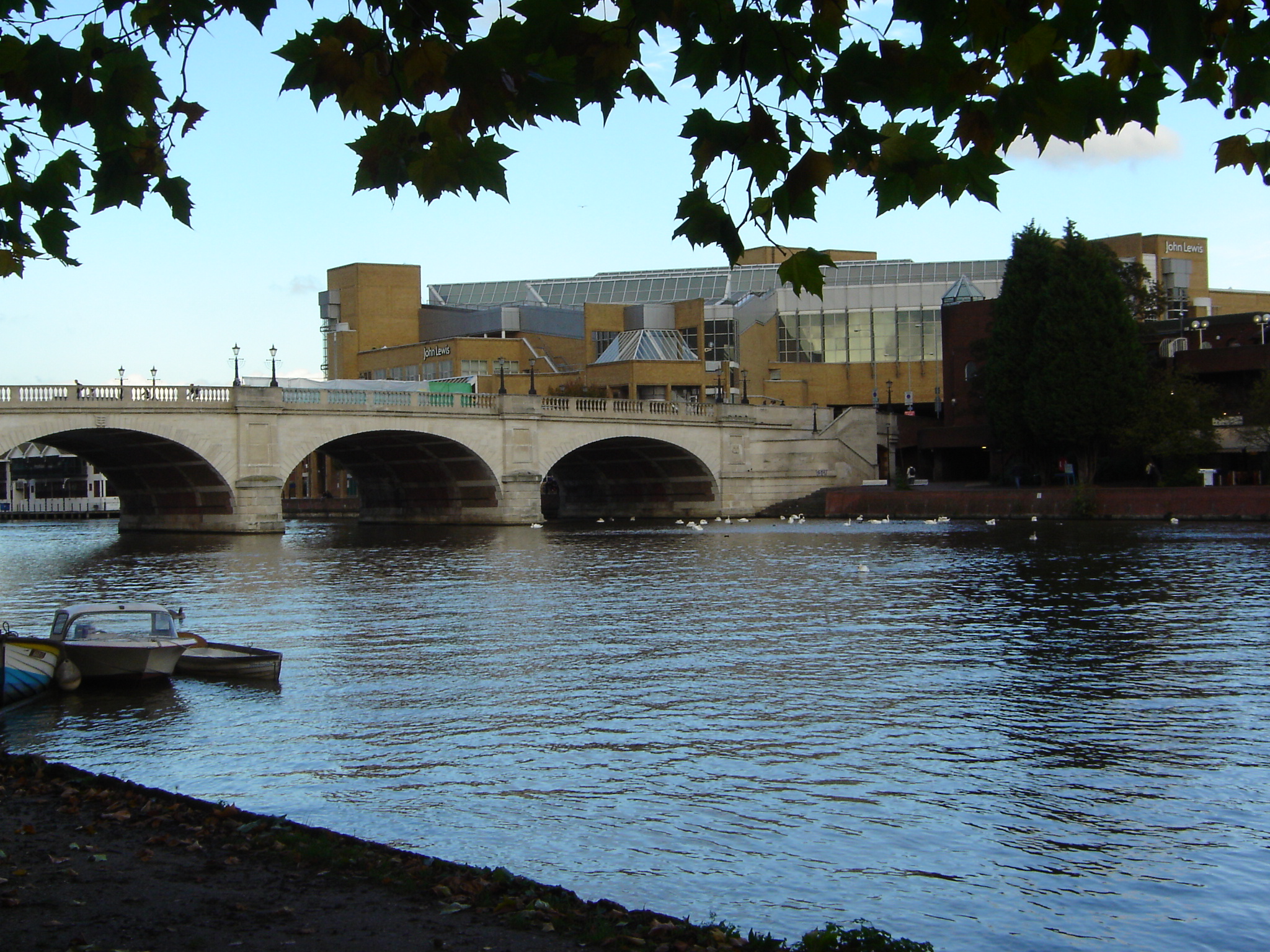
Towards the end of the clarification treatment, chlorine is added to kill any toxins in the water as its flow slows ever more sluggishly through large circular tanks open to the skies. They contain "rakes" that rotate once per hour. Finally, because we mustn't have chlorinated water going into the river, enough sodium bi-sulphate is added to neutralise it, the final bi-product being salt. Then the fresh water runs over a weir (as shown in the photo above), its flow helping to turning the last machine in the process. 

I got that last piece of information in answer to a question I asked about capturing the water's energy but what I should have asked, and only thought of later, is the question about what happens to the chemicals that get into our sewage through medication; there was no mention of this subject. Should we be worrying about it?


The catalpa tree


Half way across the Minto Bridges, on Green Island, is a stately tree that overlooks the river and comes into its own for a very brief period once a year, in early June. This is a catalpa (above) seen in full bloom. The large white flowers that cover it have a heavenly scent, too, all the more obvious when the wind drops at sunset. I kept forgetting to take my camera with me when passing by and in the end asked my husband to take this picture using his 'smart' phone. So here it is.

The flowers, leaves and bark, in close-up, look like this (courtesy of the Wikipedia):


Ça continue ...

We passed the summer solstice last week, with the skies still fairly light at 10p.m. and the sunsets colouring the rivers during our evening walks.

During the time since I published my last post in this blog, the local goslings have grown to adulthood; there seem to be more of them than ever this year, threatening to unseat my husband from his bike when he comes across them on the trail during his 25km ride to and from work, up and down the Ottawa River between here and Kanata. The summer plants on the river banks have matured too and now the waterlilies are in bloom. Herons stand and wait patiently for fish or frogs on the less disturbed side of the Minto Bridges, so motionless that it takes a careful eye to spot them.

The usual midsummer recreations are taking place on and beside the rivers and the city is installing new encouragements to linger by the Rideau Canal as well.

Riding our bikes below Parliament Hill yesterday evening with the dazzle of the setting sun in our eyes we weren't the only ones by any means; other bikes, pedal scooters and in line roller skates were constantly going by, not to mention many walkers. Those red and white rental BIXI bikes for tourists and locals alike encourage people to see the city away from the traffic while getting some healthy exercise, an excellent idea, and I like the shape of them, less intimidating for occasional cyclists like me than are fast bikes with crossbars. I haven't tried one yet, still using the rusty old machine I acquired second hand about ten years ago.

Canada Day next weekend will be the excuse for the most activity of the year on both sides of the provincial border hereabouts, and at the end of the festivities the water will, as always, reflect our colourful fireworks.


Tuesday, May 8, 2012

Gaggles of goslings

Between the Minto Bridges and our house (not very far) I counted as many as 27 goslings on the river bank. I may have missed one or two because they were well camouflaged and were huddling together in families. It rained all night and for most of today so the grass was very wet and they seemed to be enjoying its taste:

Canada Geese are primarily herbivores, although they sometimes eat small insects and fish. Their diet includes green vegetation and grains. The Canada Goose eats a variety of grasses when on land. It feeds by grasping a blade of grass with the bill, then tearing it with a jerk of the head. The Canada Goose also eats grains such as wheat, beans, rice, and corn when they are available. In the water, it feeds from silt at the bottom of the body of water. It also feeds on aquatic plants, such as seaweeds. In urban areas, they are also known to pick food out of garbage bins.
(Wikipedia)

Saturday, May 5, 2012

Bordeleau Park

Nancy dropped a copy of Echo, The Lowertown Community Newspaper into our mailbox yesterday, which I've been reading. I noticed this mention of the river:
Many residents of the 'Wedge'––the enclave bordered by King Edward, St. Patrick and the Rideau River–– were saddened last year to see the City approve a developer's plans to tear down houses from Lowertown's early days to make way for a [...] nine-storey condominium. [...] Following resident opposition the project was scaled down to five storeys. In response to residents' concerns about the project's impact on local heritage, the City has promised to conduct a heritage study of Lowertown with a view to the possible expansion of the current Lowertown heritage district. As a first step, the City invited students in Carleton University's Canadian Studies program to work with the community to produce a heritage study of the Wedge.[...]
The students [...] looked at the geography of the Wedge, where the river bank that once ran along Rose Street was modified to where it is now, some hundred metres away.
I hadn't known that.

Today in glorious Spring sunshine I saw and heard (!) eight African drummers make good use of that modified area, now known as Bordeleau Park, practising their skills on the playing field. They were impressively energetic in the way they set about it and they mesmerised passers-by, some of whom had decided to sit down on the grass in front of them to listen. I sat on a bench and then on the rocks by the river.

Next Saturday (May 12th) Bordeleau Park is to be the meeting place for a clean-up of litter from the Rideau River shoreline, from the park to the Minto bridges. Our city councillor and staff will be there, apparently with the support of the City of Ottawa and the Causeway Work Centre:
Rain or shine ... This is a good opportunity for the Wedge to join forces with other groups of the Rideau River annual clean-up. Wear boots or sensible shoes, heavy work gloves ... Refreshments will be served.

Friday, May 4, 2012

Baby trees, baby geese

I've been cycling several times across the Minto Bridges this week (which could do with some repairs) and have noticed that New Edinburgh has a large number of saplings recently planted in its park, some of them already flowering. In future years, the pathway through blossoming Amelanchier branches is going to make a very pretty approach to the river from Stanley Avenue.

A Bike Rodeo is planned for tomorrow where children aged 4-10 can meet at the New Edinburgh Fieldhouse to decorate their bikes and learn to ride safely. At the end of the afternoon there'll be a bike parade! Fifteen years ago, the citizens of New Edinburgh waged a Parks not Pavement protest to protect their green space from developers and in the morning tomorrow a commemorative walk is going to take place to celebrate the legacy of the city planning advocate Jane Jacobs.

On my ride across the Minto Bridges just now, I passed the first brood of goslings that I've seen this year. They were being guarded by both parents, on Maple Island.

Sunday, April 29, 2012

By the Ottawa River, on foot

Yesterday afternoon we walked from our house across the MacDonald Cartier Bridge, along the Ottawa River bank (on the Sentier des Voyageurs skirting downtown Gatineau) and then, across the Portage Bridge, over Parliament Hill, through downtown Ottawa and home again, a loop of 7 or 8 km.

A very pleasant walk on a cloud free weekend, and as an extra bonus, we found that "Malak's Bed" was in bloom near the Musée des Civilisations.
This garden honours the photographer Malak Karsh, “ambassador” of Canada’s Capital Region. The famous tulip photo Karsh took here appeared on Canada’s one-dollar bills, as well as on Canadian postage stamps.
 Here are some of the photos we took:

The boardwalk from the Jacques Cartier Bridge
 to the Jacques Cartier Park in Gatineau

Bank of the Ottawa River, seen from the boardwalk

The Maison Charron in the Jacques Cartier Park

Some of the snow artificially manufactured for Winterlude has still not melted

The marina by the Jacques Cartier Park, not yet in use.
View of Nepean Point on the Ottawa side.


View of the National Gallery from "Malak's Bed"
... and a view of Parliament Hill from the same spot

By the river on wheels

Green grass and willow trees by the Rideau,
between our house and the Minto Bridges
Cyclists and walkers are out in force today, everyone desperate for the sunshine after last week's cold, grey days, I assume. I'm glad to see so many parents teaching young children to ride their own little bikes along the paths. Chris and I have just come home from a short bike ride ourselves, following the trail by the Rideau River to the Hurdman corner and back, with a detour to the Rideau Falls where the viewing terrace is presently inaccessible, sealed off by a fence. I hope that means some reconstruction of the site will be happening soon.

Further upstream near the rapids between Strathcona Park and the Vanier park we sat on a bench watching the ducks, geese and people go by and enjoying the sparkle on the water. The trees are all turning green now (with catkins on the birches and bright red blossom on the maples) and there are many dandelions flowering in the green grass. We day-dreamed about cycling all the way to Kingston which at a pace of three or four hours cycling a day would take three or four days, depending on how strong we felt.

Friday, April 20, 2012

Lac Leamy

Walking round this inlet of the Gatineau River can give you a nice view of the sunset looking towards the Gatineau Hills from the eastern beach. On the opposite side of the water by the parking lot is the Bistro Le St. Eloi and a place where you can rent canoes (or, in the winter, skates, skis or snowshoes).

Wikipedia image
The lake is named after Andrew Leamy, an Irish settler in the region who operated a mill near the lake. He was married to Erexina Wright, the granddaughter of Hull's founder, Philemon Wright. The area became heavily industrialized in the nineteenth century. [...] In the 1960s much of the area around the lake was turned into a large park. (Wikipedia)
Between Lac Leamy and the adjoining Lac de la Carrière, a former quarry, is the Casino and Hilton Hotel.

On Wednesday evening, we saw a pair of loons * on the water and banks of violets flowering against fallen logs. Commandeered by a French speaking instructor, a ladies' fitness group kept overtaking us on the path round the lake, looking like a delegation from the Monty Python Ministry of Silly Walks.

*****
* On second thoughts, I think they were mergansers.


Tuesday, April 17, 2012

April by the Rideau

Last night we saw bats fluttering around the trees by the Rideau River and either a small beaver or a large muskrat swimming in the water. Birds and squirrels are busy at their nests or dreys. People are active too, with impromptu games of soccer or tennis happening on the grass. The weather's decidedly changeable, with a 20º drop in temperature last night.

Monday, April 16, 2012

Meech Creek and the former carbide mill

A popular walk near Lac Meech in the Gatineau Park takes you to the ruins of a mill on the banks of Meech Creek. This little river flows out of Lake Meech at its southern end, meanders through fields under a covered bridge and under what will soon be the extension of Highway 5 (what a mess) and eventually runs into the Gatineau River.
At the peak of the lumber trade in the 1800s this narrow watercourse channeled logs to a sawmill at Farm Point.
(From a webpage about the Lower Gatineau Heritage Trail
Wikimedia image of the carbide mill
However, the mill further upstream in the forest had nothing to do with lumber.

Thomas Leopold "Carbide" Willson (an associate of Lord Kelvin) was a turn of the (20th) century entrepreneur and scientist-engineer, the first person to own a car in Ottawa.
In 1907 he built a summer house on Meech Lake in what is now Gatineau Park. (The house is now owned by the federal government, and notable for being the site of negotiations on the Meech Lake Accord). In 1911, he began experimenting with the condensation of phosphoric acid in the manufacture of fertilizers at a mill on Meech Creek within the park. Due to this venture and running out of capital, he lost nearly all of his estate to his creditor, American tobacco king J. B. Duke.
(Wikipedia)
Photo by Chris Hobbs
You can still see traces of Willson's ambitious project (condensing phosphates to produce fertiliser) on Meech Creek, around what remains of his mill. It's a place worth seeing in any case, the waterfalls above and below it being very attractive.

Low water

The water flow to the lower reaches of the Rideau must have been regulated last week, because its surface level was very low. Rocks and debris that we don't usually see were exposed to view. Three kayaks were out on the river on Saturday, each one containing two paddlers: a risky activity, because if anyone were to fall in at this time of year, the coldness of the water would be hard to survive for long.

The River's Daily Mean Flow is measured and monitored.

Spring seems early this year though. I have already seen swallows near the Ottawa River.

I assume the Rideau Canal through Ottawa is about to be filled in preparation for the summer boats and for the Tulip Festival next month. Talking of the Canal and of festivals, there'll be a Rideau Canal Festival again this August, with flotillas, a Bike Parade and an "Environment Fair."

Friday, March 30, 2012

A cold, bright morning

Riverside path through New Edinburgh Park
The river sparkled as I walked beside it to the shops on Beechwood Avenue this morning; the north wind was bitter cold, and not many people were out of doors. I did pass a little group of small children from a nursery, out for a walk along the river bank with their minders and all holding tight to their tag straps, held in line.

Saturday, March 24, 2012

The rocks of Rockcliffe

Driving eastward round the bends of the Rockcliffe Parkway this morning I was aware of the crumbling shale cliffs (on my right) and the cliff edge over the river (on my left) that's presently being reinforced with a retaining wall, and not a moment too soon, because the sidewalk on that side looks as if it threatens to subside into the river. The ice builds up on these surfaces in winter and the pavement heaves and generates potholes in the early spring. Cyclists, beware!–– before the holes are filled in, the roads round here are full of hazards.

A geological assessment of Manor Park mentions the ...
...vertical cliff along Rockcliffe Parkway where it curves up escarpment west of the Ottawa-New Edinborough tennis courts: Cross-beds are inclined at low angles to the main, near-horizontal bedding to form wedges that are visible from the pathway across the road ...
Further down the page, the geologist reminds us that at one time there was a sea, rather than a river, here:
... limestones were deposited in a shallow (mainly < 10 m) sea on a continental shelf, or within an intracontinental basin. The limestones vary from fine-grained to coarsely crystalline and include accumulations of shell or skeletal fragments broken by wave action and marine currents.
So this is how this part of the world would have appeared during the retreat of the glaciers in the Paleozoic era; what is now Canada's National Capital Region was once under the western end of the Champlain Sea:


The thought of that big melt puts our present day springtime thaws into perspective!

Friday, March 23, 2012

Transformed


The rain washed the remains of winter away from the Rideau River and this week's unprecedented heatwave from Winnipeg to Halifax did the rest. There's no ice left now. On Petrie Island, on the Ottawa, families have been building sandcastles on the beach. Our local riverside parks, suddenly full of people picnicking on the park benches and running along in shorts, were muddy at the start of the week; the mud is drying up now. The buds on the maple trees have burst open; maple syrup yields are reportedly much lower than usual this year as the sap rising season was so short. Frogs and butterflies have been spotted and the migrant birds are settling in for the summer. Dust is settling too, all over the city.

The end of March is predicted to be back to normal.

Fog bound

Last weekend thick fog hung over the city in the early morning and till midday along some stretches of the Ottawa River. My husband, planning to fly his plane to Quebec on Saturday, had to wait patiently until it lifted or shifted enough from the runway at Rockcliffe Airport before he could safely take off ... at lunchtime. On Sunday morning a visibility reading of  0 statute miles was reported at nearby Gatineau Airport; that is very unusual indeed.
OTTAWA/GATINEAU/QC
SPECI CYND 181249Z 00000KT 1/8SM FG VV001 RMK FG8=
SPECI CYND 181230Z 00000KT 1/4SM FG VV001 RMK FG8=
METAR CYND 181200Z 00000KT 0SM FG VV000 01/01 A3018 RMK FG8 SLP222=
METAR CYND 181100Z 00000KT 0SM FG VV000 01/01 A3017 RMK FG8 SLP219=
TAF CYND 181238Z 1813/1901 00000KT 1/4SM FG VV001
BECMG 1813/1814 3SM BR FEW004
FM181500 22006KT P6SM FEW030
RMK NXT FCST BY 181800Z=

Monday, March 12, 2012

Catching people's attention

My attention was caught by this shocking picture (!) and article on the front page of Ottawa's free Metro paper, last week. There is raw sewage in the Ottawa River after heavy rainfalls and we (tax payers) have to be willing to spend money to do something about it. The City of Ottawa's Ottawa River Action Plan lists plenty of proposals to deal with the problem, but they don't come cheap.

Saturday, March 10, 2012

Winter's coming to an end

Waxwing (RSPB image)
It rained on the melting snow and ice last week and now there's a freeze again so that the Rideau River has a smooth sheen. The "keys" (blocks of ice in the shape of a keystone) cut by the icebreaking crews stick out of it, some of them deformed by the thaw, and the amphibious excavator is working slowly upstream past New Edinburgh towards Vanier. The sky is bright.

This was a sight worth seeing yesterday: waxwings, a woodpecker, a chickadee, several migrating fieldfares and an American robin, all foraging in the trees and bushes between St. Patrick Street and the Rideau River.

Don told me yesterday that he'd seen geese flying north.

Sunday, March 4, 2012

A month away

The latest winter storm has blown through, the sky has cleared, and they are blasting the Rideau River near our house today. I wrote about that, this time last year.

Camellia bushes on the riverbank, Tokyo

Kiyosubashi, a bridge near our hotel in Tokyo

Police boat and cruise boat on the Sumida

Shinohashi Bridge, Tokyo

Footpath beside the Sumida River, Tokyo


Since my last post I've been away beside several overseas rivers, one of which, the Sumidagawa, flows into Tokyo Bay. It is actually a 27km canal through the city, with a whole series of impressive, attractive bridges. More often than not it seems to be full of waves, perhaps because of the speed the riverboats sail at, causing a turbulent wake. What I liked best about the river was its recently landscaped banks, lined with neatly trimmed trees, bushes and flowerbeds. The pansies and camellias were already in bloom. In the summer it would be pleasant to sit on the park benches under the arbours that have been constructed, entwined with wisteria. Runners use the riverbanks for their jogging routes and I thought these promenades would be a good way to walk through the city from A to B without getting too much pollution in one's lungs, although on several stretches a motorway runs above one's head on concrete stilts and the noise of the traffic is noticeable. These road bridges keep homeless people out of the rain, so they have built their shelters there out of tarps or cardboard boxes, carefully tied up with string while they're not sleeping in them. I've never seen such neat and tidy street people. Their self-discipline in that regard was one of the things that amazed me about Tokyo. Behind the walkways, factories, office blocks and apartment blocks line the river on either side with hardly a metre of space to spare between them.

The River Avon at Bristol, UK 
The Avon quayside
Other rivers I encountered on my travels last month were the Avon in Bristol, the Taff in Cardiff and the Thames at Reading (we walked along the Reading towpath on the afternoon of Feb. 21st after sitting in an aeroplane for 12 hours––that's an invaluable cure for jetlag!) and Kingston(-upon-Thames) in both of which towns we saw swans taking off heavily from the water. In Kingston we watched them, as well as rowing boats, kayaks and canoes, from a window seat in the cafeteria at the John Lewis department store with our daughter and family.

A nice variety of rivers and experiences to remember! It was good to see flowing water instead of ice and snow for a change, this winter. Any day now we'll see the water flowing freely down our local rivers too.

Thursday, February 2, 2012

February posts

Until the last few days of this month we'll be away, with my husband at work in Bristol (our hotel close to the River Severn) and in Tokyo (on the banks of the Sumidagawa), so, for blogposts about the Rideau and the Ottawa, here's the link to what I wrote during February 2011. This year's posts, had we stayed at home, would doubtless have been much the same as last year's.

Monday, January 30, 2012

Skiing down the river

As I crossed the St. Patrick Street bridge across the Rideau my eye was caught by the tracks on the river's white surface below me, in an almost perfect herringbone pattern. Someone who trusts the thickness of the ice at this time of year had been skate-skiing right down the middle of the river. I came back across the bridge later and noticed the footprints of both people and animals, mostly closer to the bank. Someone had been walking along on top of the river in snowshoes too.

Monday, January 23, 2012

Talk of sewage and salt

Should the city's environmental priority be Light Rail or sewage control?—that is the issue in the local news at the moment.

It's raining today and the city's water pipes will be in full use, draining dirty water from the salted roads. What goes down the drain is a subject of hot debate, with the Ottawa Riverkeeper website publishing their opinion on the matter in their blog and on their news page.
"According to Ecology Ottawa, the city discharged 417 million litres of sewage and rainwater into the river in 2011. That’s enough to fill 166—wait for it—Olympic-sized swimming pools. People may differ on whether LRT or the Ottawa River is the city’s main priority, but I think we can all agree it’s time to come up with a new gigantic unit of volume."

Wednesday, January 18, 2012

Long shadows and shining trees

The winter sun is low in the sky. Long blue shadows lie across the snow at the river's edge and ice sparkles in the maple trees after last night's freezing rain.

We were out walking in that rain and particularly exposed to it while crossing the bridges over the Rideau, struggling to keep our feet from slipping. All for the sake of a breath of fresh air.

Monday, January 16, 2012

Down by the riverside ... it's colder!

Cold, bright weather at Britannia Point on the Ottawa
During the current cold snap, people have been noticing and commenting upon the difference in temperature measurements between the temperature readings at Ottawa International Airport (formerly "Uplands"––374 ft ASL) and at Gatineau (211 ft ASL), hardly any distance further north, but closer to the Ottawa River. Here's an article from the Ottawa Citizen that explains the phenomenon.
Cold air is heavy and it drains. [...] That’s why White River was for years considered the coldest place in Canada. It’s in what we call a frost hollow.
Actually the temperature in White River today is +1ºC, whereas in Gatineau it's -12º (feels like -19º).

Ontario weather is variable.

Thursday, January 12, 2012

A home made ice rink

I see that I can "share this picture" (posted on The Weather Network) on my blog, if I wish. Pointe Gatineau is at the conjunction of the Ottawa and Gatineau Rivers.

Well done, Mr. Savage!

Wednesday, January 11, 2012

Purifying the river water

In Ottawa, our drinking water comes from the river, but not before it's been filtered through the Water Purification Plants (WPPs):
Part of the Water Purification Plant at Britannia
At Britannia and Lemieux Water Purification Plants, sophisticated water purification techniques are used to treat Ottawa River water to drinking water quality standards. The source water from the river, while of excellent quality, does present a number of challenges to the treatment process. Seasonal variations in temperature and suspended organic loading in the summer require changes and on-going monitoring of the treatment processes and resulting water quality. The water treatment process consists primarily of the removal of particles from the source water by the processes of coagulation, mixing, settling and filtration. Once the partially treated water is passed through the filters, chlorine is added as a primary disinfectant in order to meet the Ontario Drinking Water Quality Standards. Other chemicals are also added to the water for corrosion control purposes within the distribution system and for dental health purposes. The Ministry of the Environment inspects all of the City’s drinking water systems on an annual basis and have found them to produce excellent water quality.
We passed the Britannia Plant the other day on a walk around Mud Lake.

The water is distributed to city dwellers through 15 pump stations, besides which some of the outlying communities rely on groundwater wells.

That quotation from the City of Ottawa website is a bit vague about the additives (other than chlorine) that we're drinking in our water; the perceived wisdom suggests that they're doing us more good than harm, but like many other people, I like to supplement my drinking water with spring water from time to time. At present this can be collected for free from the spring on the hillside at Wakefield. I hope the containers I use don't contaminate it.

Monday, January 9, 2012

Dormant

The winch
Life on the Ottawa River seems suspended during the winter. The Rockcliffe Yacht Club's boat winch stands neglected in the snow, waiting to be used next season, and the plants on the bank are in a state of dormancy too, making shapely silhouettes in shades of black, dull brown and grey.

All the same, these off-season scenes have an allure that can be addictive. Best wear skis or snowshoes on the riverside trail; the snow is deeper here than in other places. With the bank facing away from the sun it doesn't melt so fast.
Sumac in winter

Milkweed stalks

Sunday, January 8, 2012

Sunset, moonrise

Here are three views from the edge of the Ottawa River taken yesterday afternoon around 4 p.m. (on the Ontario bank below Rockcliffe airport).


Crossing the river by 'plane

Precipitation to the west, looking towards Arnprior
Up there, the views are different. Yesterday's flight was particularly awe-inspiring because of the unusual atmospheric conditions, rising moisture from the city forming swathes of mist and the sun low in the sky casting its rays through a grey overcast; intermittent winter showers were blowing in from the west down the Ottawa Valley. On the ground it was calm; a few hundred feet AGL the upper winds began to be noticeable. You can see the effect of the wind sheer on the plume of steam from the Kruger tissue mill (beyond the Alexandra Bridge) in these pictures.

Ottawa and Gatineau on a winter's afternoon
After I had come down to earth, my husband took another, better photographer (Chuck Clark) flying as well, by which time we were experiencing the full splendour of a winter sunset. The pictures he took are sensational.